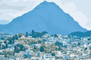
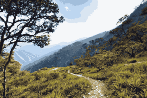
Pithoragarh is a beautiful town in the Kumaon hills of Uttarakhand, located at a height of about 1,800 metres. It is a calm and peaceful place where you feel like staying longer. Also, the town is surrounded by pine forests, and you can see amazing views of the Himalayan mountains from many places. It is not too crowded, which makes it even more special. Moreover, Pithoragarh is an important administrative center of the region. For pilgrims and trekkers, it is very important because it is the last big town before the high mountains start.
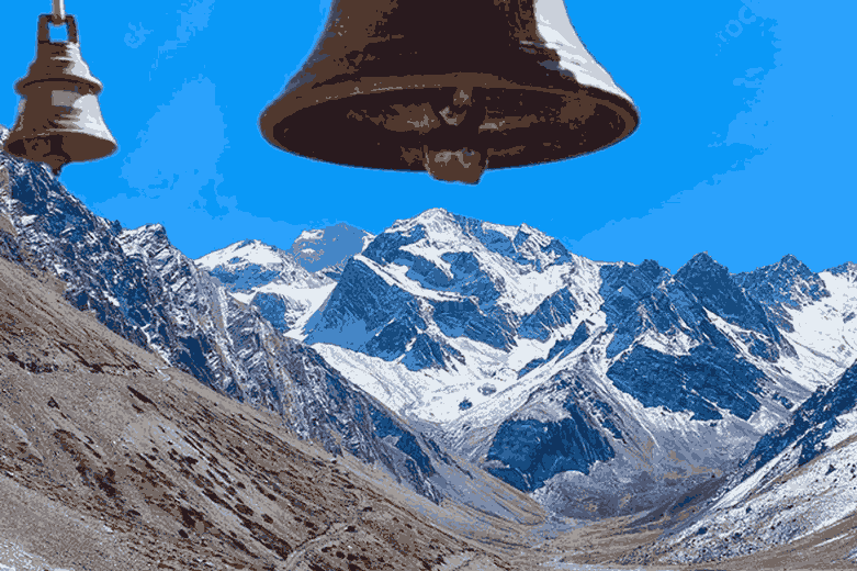
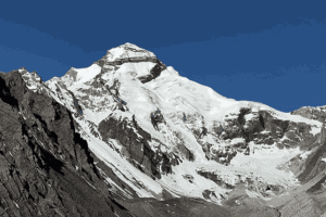
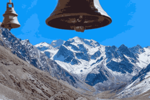
Adi Kailash, also called Chhota Kailash, Shiva Kailash, or Baba Kailash, is a very sacred mountain. It stands at a height of about 6,310 metres and is located deep inside the Pithoragarh district. Many Hindus believe that it is a reflection of Mount Kailash in Tibet, which is known as the home of Lord Shiva. In fact, the mountain looks very similar to Mount Kailash in shape. At the base of Adi Kailash is a peaceful place called Jolingkong, where you will find a beautiful lake named Parvati Sarovar. Overall, the spiritual feeling of this place is very strong, and it feels calm and pure.
The distance: 170 kilometres Journey
The road distance from Pithoragarh to Adi Kailash is about 170 kilometres. At first, this may not seem very long. However, in the mountains, the journey is more challenging. The route passes through Dharchula, Tawaghat, Gunji, Nabi, and finally Jolingkong. Along the way, you will see beautiful valleys and rivers. Thanks to road improvements by BRO, much of this route is now motorable.
Travel Time: Be Patient on the Journey
Set aside 7 to 9 hours for the full drive from Pithoragarh to Jolingkong, and that’s on a good day. This is because mountain roads are very different from plains. There are sharp turns, narrow roads, and sometimes delays due to animals or permit checks. As a result, the journey takes more time.
So, most organised yatras split the journey into two days. First, you travel from Pithoragarh to Dharchula and stay overnight. Then, on the next day, you continue towards Gunji and finally reach Adi Kailash. This way, your body also gets time to adjust to the high altitude.
Places You Cross on the Way to Adi Kailash
Pithoragarh (1,814 m)
Your starting point. Stock up on supplies, sort your permits, and fuel up — in every sense of the word. The town’s small bazaar is charming for an early morning stroll.
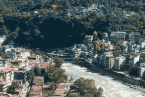
Dharchula (~90 km, 1,067 m)
A bustling border town straddling the Kali River, with Nepal’s Darchula visible just across the water. This is where Inner Line Permits are issued and where regular vehicles give way to sturdy 4×4 Boleros.
Tawaghat & the fork
About 18 km beyond Dharchula, the road splits. Left goes to Darma Valley; right takes you toward Adi Kailash. After Tawaghat, there are virtually no shops for 27 km — pack accordingly.
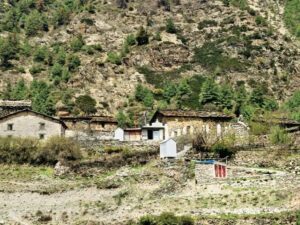
Budhi, Garbyang & Gunji (~3,000 m)
Ancient villages clinging to steep hillsides, where locals still practise centuries-old traditions. The air gets noticeably thinner and clearer. Gunji is a key overnight stop and checkpoint on many itineraries.
Nabi & Navidhang (~4,000 m)
From Navidhang, on a clear day, you can witness Om Parvat — a mountain whose snow-covered face bears a naturally occurring ॐ (Om) symbol. Pilgrims often weep here. It is genuinely extraordinary.
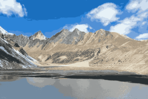
Jolingkong / Adi Kailash base (~4,300 m)
The meadow at the foot of Adi Kailash, with Parvati Sarovar shimmering nearby. The peak rises before you in unmistakable splendour. You have arrived.
Road conditions: beautiful, rough, and unpredictable
Let’s be honest: the roads beyond Dharchula are not for the faint-hearted. The BRO has done remarkable work carving motorable paths through terrain that was once pure trekking country, but mountain roads remain what they are — narrow, winding, occasionally crumbling at the edges, and subject to the mountain’s own moods. Between Tawaghat and Gunji, expect stretches where the road hugs cliff faces with a dramatic drop on one side and a sheer wall of rock on the other. Beyond regular vehicles, only 4×4 vehicles — typically Mahindra Bolero or Bolero Camper — are permitted and recommended. Landslides, particularly during and just after the monsoon, can temporarily block the route. Always check conditions locally before departing from Dharchula.
Best time to visit
The yatra season is officially open from roughly May through October, but the sweet spots deserve a closer look.
May – June (ideal)
September – October (ideal)
July – August (possible, but risky)
November – April (closed )
May and June offer clear skies, blooming alpine meadows, and the best views of Adi Kailash and Om Parvat. September and October bring post-monsoon clarity, golden light, and a quieter crowd. July and August, while accessible, carry a real risk of landslides and disrupted roads — a risk most experienced travellers prefer to skip. The high passes are snow-locked from November through April, making the route impassable.
Things You Should Know Before the Journey
Permits
An Inner Line Permit is mandatory due to the route’s proximity to the Indo-Tibet border. Obtain it at the SDM office in Dharchula or Pithoragarh. Carry ID proof, passport photos, and a medical certificate. Tour operators can often arrange these in advance.
Vehicles
Beyond Dharchula, only 4×4 vehicles navigate the terrain. Bolero Campers are the standard. Book locally or through your tour package — don’t attempt this stretch in a standard sedan or SUV.
Acclimatisation
Altitude sickness is real. Spend a night at Nabi village (around 3,200 m) before pushing to Jolingkong. Stay hydrated, avoid alcohol, and ascend slowly. Those with heart or lung conditions should get medical clearance before the yatra.
Accommodation
Guest House and homestays are available at Dharchula, Gunji, and Nabi. Facilities are basic but warm — expect hot meals, simple beds, and the kind of hospitality found only in remote mountain communities. Book ahead during peak season.
What to carry
Heavy woollens and a windproof jacket (temperatures at Jolingkong can plunge below zero even in May), a first-aid kit with altitude sickness medication, dry snacks, a reusable water bottle, and — crucially — cash. ATMs are non-existent beyond Dharchula.
Conclusion
The journey from Pithoragarh to Adi Kailash is not just about reaching a place, but about experiencing the beauty and peace of the Himalayas. From scenic roads and small villages to the sacred view of Adi Kailash, every moment of this journey feels special.
With proper planning, permits, and basic preparation, this yatra can be safe and memorable for every traveler. If you are looking for a spiritual and peaceful trip, Adi Kailash is truly worth visiting.
